Name of Object:
Carte du royaume de Tunis
Location:
Tunis, Tunisia
Holding Institution:
Musée de la Monnaie : Banque centrale de Tunisie
Date of Object:
1727
Material(s) / Technique(s):
Papier
Dimensions:
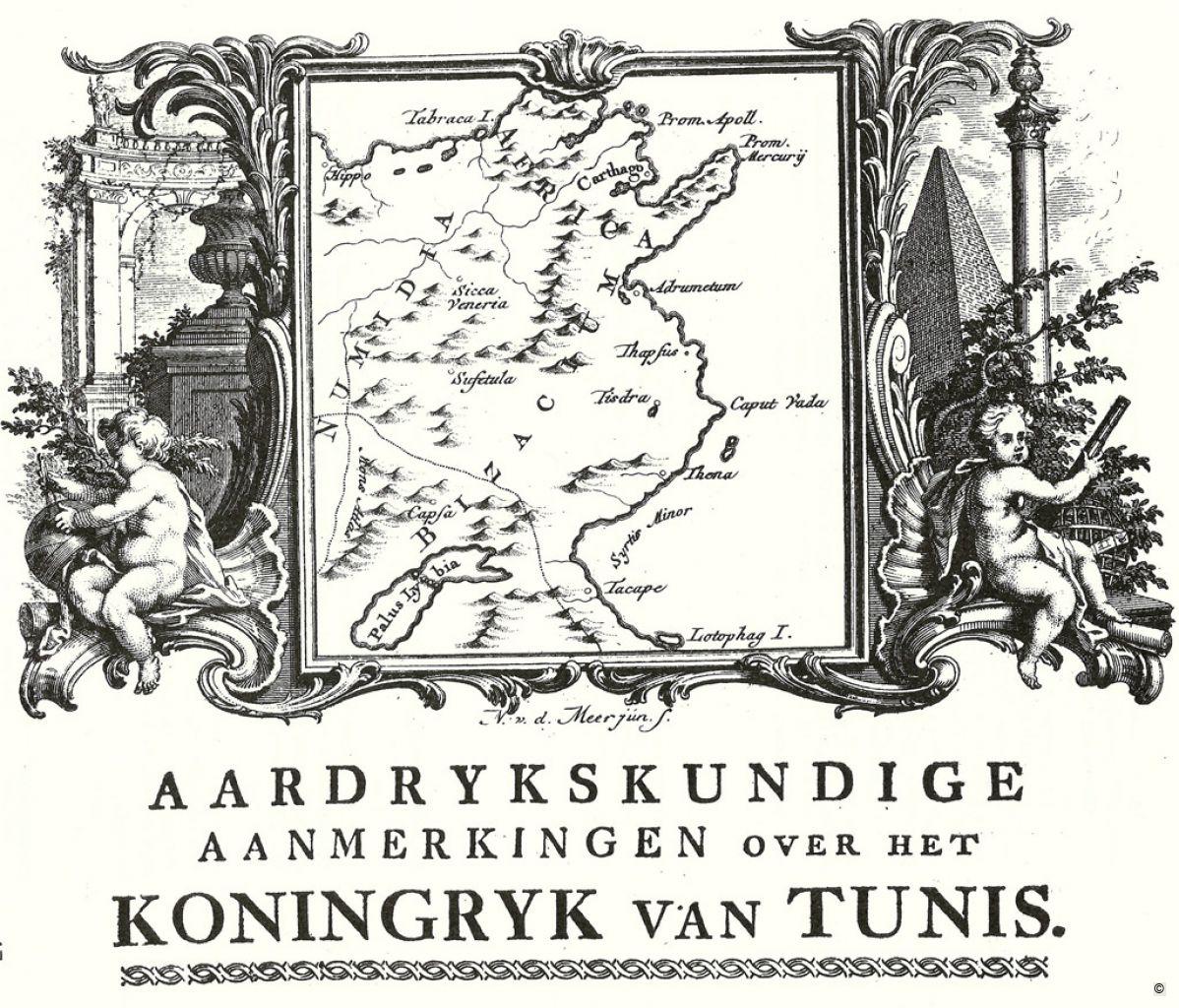
Map of the Beylik of Tunis
Description:
This is a copy of a map of the Beylik of Tunis by Sir Thomas Shaw, an English naturalist and traveller. It was one of the first Western maps of the area. Sir Thomas Shaw wrote all the names of all the ancient Roman towns, clearly marked the borders of Africa Romana and Numidia and the ancient sites of Carthage, Sicca Veneria, Suffetula, Hadrumetum, Thysdrus, Tacapae, and more.
Archival or Bibliographical Reference:
Shaw Thomas, “Geographical Description of the Kingdom of Tunis”, in Philosophical Transactions, 1729 ; Travels or Observations Relating To Several Parts of Barbary and the Levant, Oxford, 1738- 46 fol, 2 vol – London
Citation of this web page:
Saloua Khadhar Zangar "Carte du royaume de Tunis" in "Sharing History", Museum With No Frontiers, 2025.
https://sharinghistory.museumwnf.org/database_item.php?id=object;AWE;tn;49;en
Prepared by: Saloua Khadhar Zangar
Translation by: Flaminia Baldwin
MWNF Working Number: TN 049
Related Content
On display in
Exhibition(s)
Sharing History
Rediscovering The Past | Mapmaking | Mapping The PastMWNF Galleries
Prints and drawingsDownload
As PDF (including images) As Word (text only)