Romania
Previous | Page 1 of 3 | Next

18th century map – Moldova, Valahia and Transilvania are in the left
1782
National Museum of Romanian History, Bucharest, Romania
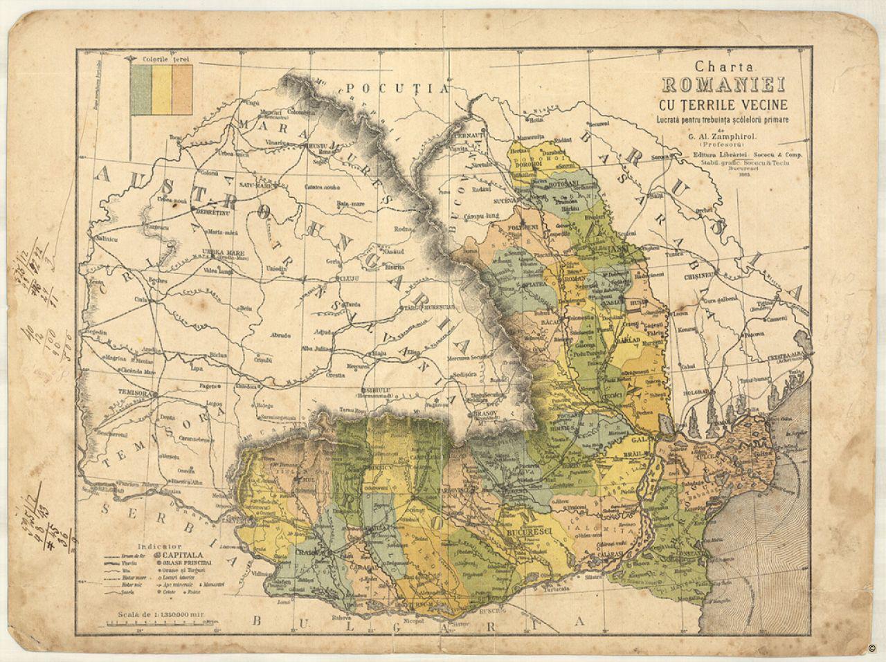
Map of Romania and the neighboring states
After 1878 – before 1913
National Museum of Romanian History, Bucharest, Romania
The precursors of the Romanian state
At the beginning of the 19th century, a state comprising all the Romanian population inhabiting the territory of present-day Romania did not yet exist: Wallachia (in the south) and Moldavia (in the east) were under Ottoman sovereignty; Dobruja (in the southeast) was a province of the Ottoman Empire; Transylvania (in the centre), Banat (in the southwest), Partium (in the northwest) and Bukovina (in the northwest of Moldavia) belonged to the Habsburg Empire; and Bessarabia (the eastern part of Moldavia) was annexed by Russia in 1812. The basis of the Romanian state was laid in 1859 through the union of Moldavia and Wallachia, which was possible as a consequence of the Ottoman Empire’s decline that had started at the end of the 17th century after the defeat in the Great Turkish War (1683–99) against the Holy League.
Related Content
Political Context Timeline Romania
Download
As PDF (including images) As Word (text only)